Get the apps

Computer Vision · Flight Physics · Geospatial

Every golf shot,
recorded by technology.

TeeShot builds golf technology that reads the flight of the ball in a video and the distances on the course with precision. Computer vision, flight physics and satellite maps come together in two apps.

  • iPhone · Android
  • Free
  • No sign-up · No ads

Products

Two technologies, two apps.

TeeShot Tracer

Vision AI × Flight Physics

Turn a swing video into a broadcast moment.

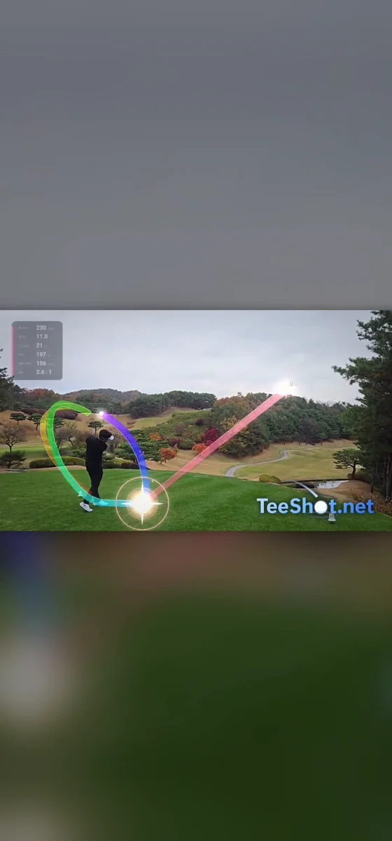
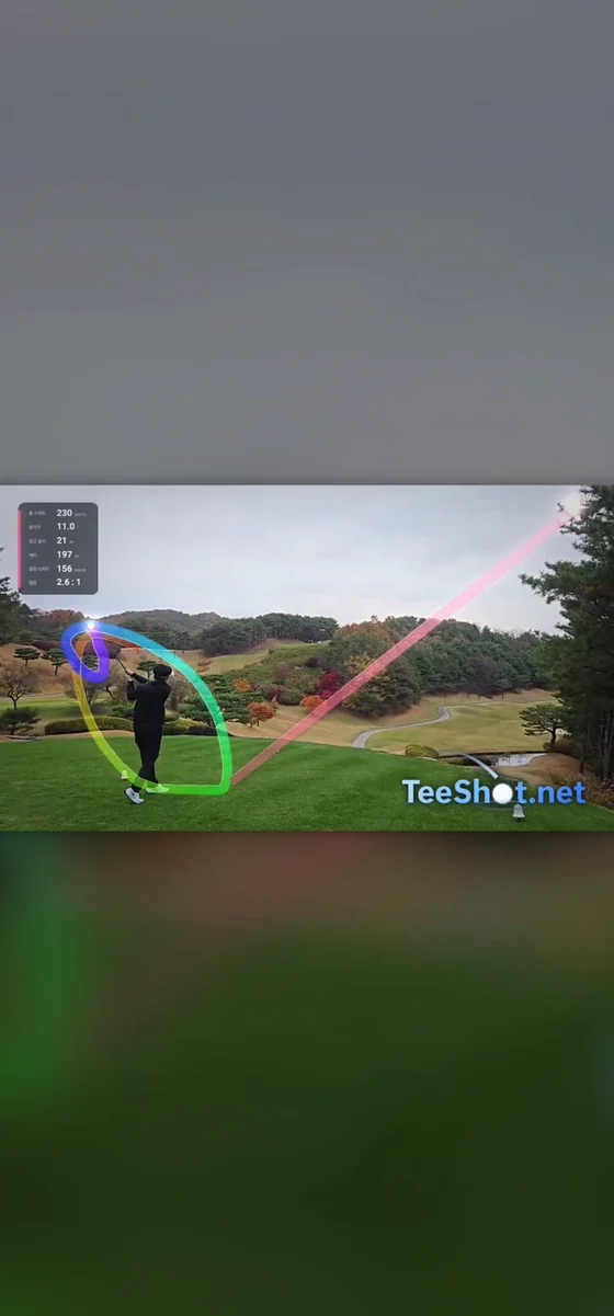
Draws the ball's flight and the swing path onto a single tee-shot video, with carry distance and ball speed. From analysis to the finished video, everything runs on your phone.

  • Ball flight
  • Swing path
  • Distance · Ball speed
  • Reels · Shorts 9:16
Download on the App Store Coming soon
TeeShot Tracer: the ball's flight and the swing path drawn over the video at impact
TeeShot Tracer: the finished video with the swing path, the ball's flight and the data card

TeeShot Caddie

GNSS × Satellite Map

Precise yardage on satellite imagery.

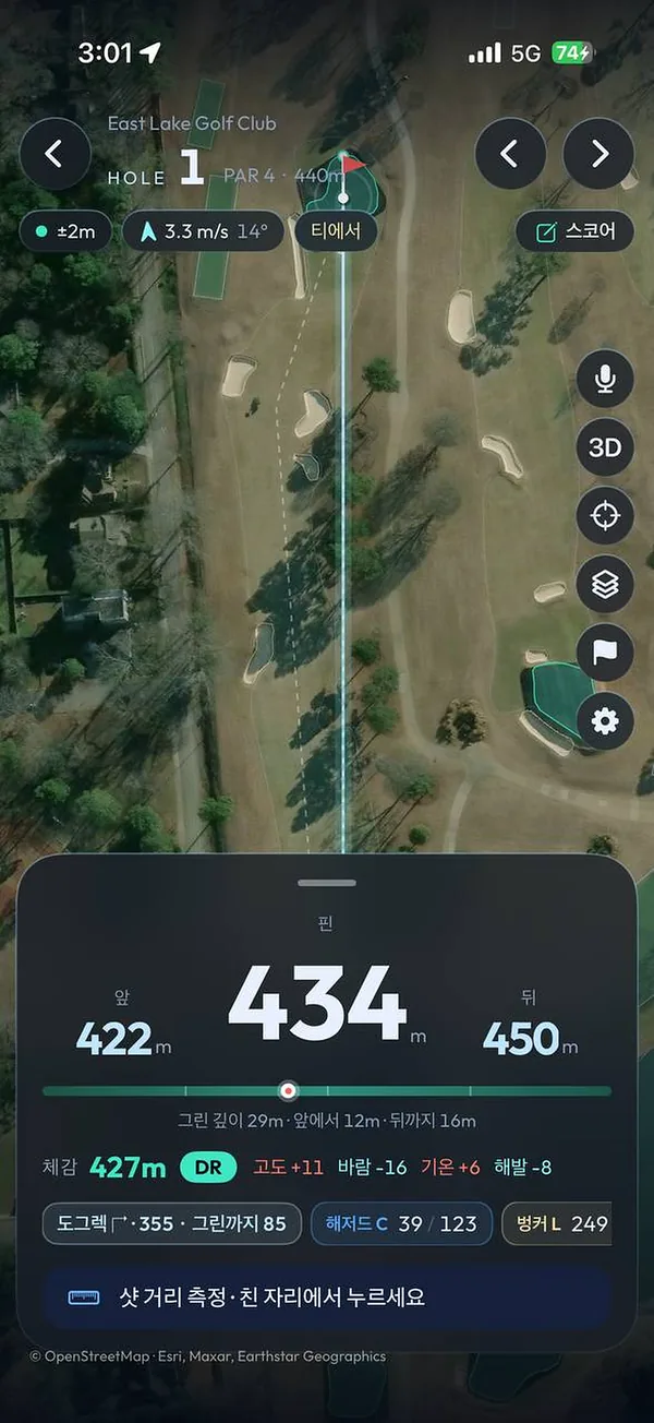
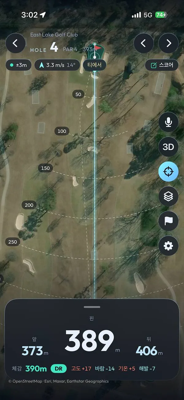
See front, center and back distances to the green on a satellite course map, plus a plays-like distance adjusted for wind and elevation, all on one screen.

  • Front · Center · Back
  • Plays-like distance
  • Club advice
  • Scorecard
Download on the App Store Get it on Google Play
TeeShot Caddie: hole map on satellite imagery with 434 m to the green
TeeShot Caddie: hole map with distance rings every 50 m from the tee

Technology

The technology behind the screen.

TeeShot Tracer

Vision AI × Flight Physics

Finds the ball and the club in the video, and carries the flight the camera cannot see with physics.

MediaPipe Pose Landmarker · 33 landmarks

AI pose estimation

Custom-trained club-head model · on-device inference

Club-head AI

Time-series analysis of ball color and contrast

Impact detection

Morphological candidates + Viterbi optimal path

Ball flight tracking

Air drag + Magnus lift · 400 Hz integration

Flight physics model

2 unknowns (k, F) · robust least squares

Camera model fitting

TeeShot Caddie

GNSS × Satellite Map

Corrects your position and draws the course and distances on satellite imagery.

GNSS position · Kalman-filter sensor fusion

Precision positioning

In-house satellite tile renderer · course-aligned rotation

Satellite course map

OpenStreetMap course data · dedicated cache server

Worldwide course data

Satellite region growing · shape classification

Green detection

Wind · temperature · altitude · elevation change

Plays-like distance

Gyro swing detection · automatic shot log

Shot tracking

400Hzflight-physics simulation
33AI pose landmarks
2iOS and Android at once
0sign-ups · ads

Download

Get them on your phone.

Free to install. Once installed, the apps work anywhere in the world.

TeeShot app icon

TeeShot Tracer

Shot-trajectory videos · TeeShot Tracer

Download on the App Store Coming soon
TeeShot Caddie app icon

TeeShot Caddie Golf GPS

Golf GPS · satellite course map

Download on the App Store Get it on Google Play

Store availabilitySouth Korea · United States · CanadaOnce installed, the apps work at any course or range in the world.